Sunday, December 2, 2007

Whole Foods

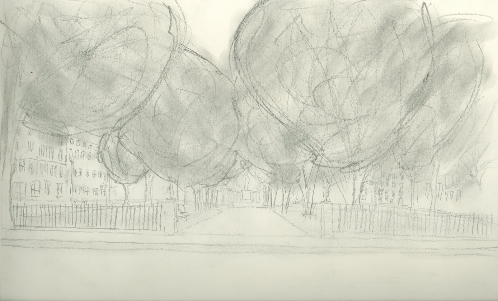
Located on the corner of Westland Avenue and Edgerly Road, Harry Ellis Dickson Park (aka Whole Foods Park) is a small park that was developed in memoriam to Harry Ellis Dickson, an associate conductor laureate of the Boston Pops. 

The sculpture in the center in the park is “g” clef twisted to form what is seen today. The modern appeal of the sculpture plays off the modernist parking garages on the northern side of the site which houses the whole foods supermarket. The backside of church park lines the other side of Edgerly Road. There are townhouses that line Westland Avenue

The site has a modern feel to it. Its unique sculpture adds to the feel of the space and gives it a nice focal point. The openness of the park gives off a very public appeal. People are often seen walking through the park, or enjoying a cup of coffee with sitting on one of the benches. 

The scale of the park in comparison to surround buildings is very small, however it makes a big statement and adds to the overall feel of the area. 

Tent City

Tent City is a housing complex that was built as part of a low income housing project in the late 1960’s. The building faced extreme opposition by community memebers. 

The lot that Tent City was developed on was a vacant parking lot a couple blocks south on Darmouth Street from Copley Square. The reason behind it being calles Tent City is the amount of homless people that would pitch tents on the lot and call it home.

The building is very uniquely designed. The architects had to create a transition space from the growing towers in the Back Bay to the townhouses that lined the streets of South Boston. The final design looks similar a stair case, stepping down from a twelve story tower to a four story townhouse.
The space of analysis was an open courtyard that is enclosed on three sides by the apartment structure. The space gives off a very warming feeling. The surrounding buildings acts as a sound barrier preventing most noise from entering the space. There is also a very private feeling to the space that often comforts the person experiencing the space. The vegitation primarily lines the small street that divides that main building from several smaller structures on the site. 

Northeastern University

The Northeastern West Village Quad is located off of Parker and Ruggles Streets in the Roxbury section of Boston. When experiencing this space, several things came to mind; 

The quad is circular in shape with openings on the main axis. To the west the space exits to Ruggles Street. To the north the space exits out onto Parker Street. To the south and east the space empties into the rest of Northeastern’s campus. The space is very busy. Whether it is through the movement of students through out the space or through the cars that sporadically pass through the space, you feel that its not really a space that is to be enjoyed from the ground but from the rooms that surround the space. 

It can often be felt that the quad is the main point on this part of campus where students transition to other parts of the university. The design of the space is quite simple and plays off the simplistic architecture of the buildings surrounding it. The simplicity of the space allows for people experiencing the space to focus on their destination because more than often the viewer’s sight goes towards the exits and the sights beyond.

Thursday, November 1, 2007

Adams Park - Roslindale

Roslindale, a neighborhood of Boston, is a quaint little village that gives off a very different appeal then the city that it associates itself with. The main pass through Roslindale is Washington Street. Near the center of this neighborhood lies a quaint little park; Adams Park. At this point traffic on Washington street is routed around the park, providing ample service to the small shops and boutiques that border the park and define the center of the neighborhood.

The park itself is small in size, yet fits the needs of the community. The main path through the park runs east west providing pedestrian access from Cummins Highway to South Street. The park is lined with trees on all sides with several monuments within its borders.
The feeling that this park and surrounding structures gives off, makes it hard to believe that its a part of a larger city. It feels like it belongs in a small suburban town way outside of Boston. Community members of this park are often seen gathering at is center enjoying the gardens and the small town feeling that it gives off.

Friday, October 26, 2007

Institute of Contemporary Arts, Peir 4, and the Harbor

South Boston was transformed over time to fit the needs of the city. Recently it has seemed to hit a slow point. The harbor front in this part of the city is sparsely developed and contains multiple paved deserts lined with cars. The space itself is bordered by pier 4 to the south and several sea walls on all other sides. Tucked in the lower south east corner resides the Institute of Contemporary Arts.

Facing the north, views expand into the distance across the harbor to Charlestown on the opposite side. Views to the South overlook the multiple parking lots and beyond to the convention center and buildings beyond. The south east brings views across to Pier 4 and beyond to the islands in the distance.

The space gives off a very tranquil feeling even though it is so close to downtown. Its often enjoyed by people strolling along the walk ways that hug the harbor's shore. Often people can be seen sitting along the wall, enjoying the views and takign a rest from their activities. Possible future development brings a potential promise to the site, hoping one day that space will be full of activity instead full of cars.

Wednesday, October 10, 2007

Christian Science Center

Founded in 1879 by Mary Baker Eddy, the Christian Science Center is home to The First Church of Christ, Scientist. The space contains multiple structures of varying heights. The tallest being the administration building in the far southeastern corner of the site. The particular portion of analyzation was the far western portion of the Christian Science Center, Mass Ave, and over into Church Park. The history of the site is unknown to me however, it can be deducted that multiple buildings, roads, and other infastructure had to be demolished in order to create what is currently there. The old portion of the The First Church of Christ (pictured below, right) was constructed in 1894 with the founding of the organization. The addition to the church, the larger, more prominent and well known structure, was constructed in 1904. 

Additions to the site were completed at two separate times. The Mary Baker Eddy Library was constructed in the northwestern portion of the site and was completed in 1934. The current plaza, the administration building, the colonnade, as well as the sunday school building all were constructed during the 1970's. The plaza consists of a pool which lines the center of the space providing reflections of the surrounding buildings and cityscape. A green space in the western portion gives an inviting feeling to the site. Bounded by two major avenues on the western and southern boundaries (Massachusetts and Huntington Avenues), there is some feeling of chaos. 

In the particular portion for analysis, there is constant traffic running through the space. Massachusetts Avenue divides the space in two with the Christian Science Center to the east and Church Park to the west. The openness of the plaza on the eastern portion allows for maximum pedestrian movement. The sidewalk along the western edge provides some safety from the avenue, however it can be a little busy. In relation to surrounding neighborhood, the site is surrounded by quiet side streets lined with victorian era architecture as well as many brownstones (typical of the Back Bay neighborhood). The concrete contemporary construction of Church Park with the several varying architectures of the Christian Science Center some what contrast with the surrounding neighborhoods. 

Wednesday, October 3, 2007

Back Bay Fens

The Back Bay Fens was created in response to the filling of a marsh tidal zone. Completed in 1900, the Fens created a space for recreation as well as an area to act as a flood barrier, protecting the city. The natural feeling of the Fens is accomplished through the strategic planning of greenery, as well as the through the winding river that runs through the park. The park however, at times, feels like a barrier. The space that was analyzed was a portion of the park with football and basketball courts (shown in the photo below). 

The Barrier feeling begins on the north with the island that seperates the two streets. The smaller street is primarily used by residents, while the wider street that runs parallel is used by heavier traffic. A line of of trees line the island and boarders both the north and south sides of the park. Elevation differences also create a barrier. On the southern side, a large hill seperates the road from the river. On the northern side there is a small hill leading to the road above. 

Copley Square

Copley square was created in 1858 from the filling of the Back Bay. The square is surrounded by Boylston St to the north, Clarendon Street on the East, St James St on the south, and Dartmouth St on the West. The area of study for this was a portion of St. James between the Trinity Church and the John Hancock tower. The space of study flowed freely to the east and west, with an intersection of Clarendon St to the east. Trinty place runs adjacent to St. James St, bounding the space on the west side. Trinity Church lines the space on the north side, and the John Hancock tower to the south. 
The space has an extremely busy feel. Cars and pedestrians constantly flow in and out of the space. The outlets on the east and west sides provides both exits and access points into the space, adding and subtracting to the flow of every day traffic. Trinity church and the Hancock Tower frames certain views east to downtown Boston and west to the Prudential complex. Shadows from the Hancock tower often dwarf the space, but provides comfort to the square below at certain times during the day.

Wednesday, September 19, 2007

Commonwealth Avenue

Comonwealth Avenue starts at the main entry to the Boston Public Garden and runs through the Back Bay neighborhood, Kenmore Square, and on into Brookline. The primary focus of this project was to analyze the strips of park that run from the Public Garden to Kenmore Square. The parks that line the center of Commonwealth Avenue total nine, however the primary area of study was the very first park that lies between Arlington Street and Berkeley Street. 

The park, like the Gardens, has a very open and public feel. Upon my visit, there were multiple people enjoying their every day activities within the park. The fence at the eastern end of the park defines the entrance, and the trees that line the outside edges creates an open border, yet defines the park. The central sidewalk runs through all nine of the parks total giving pedestrians another option other than the typical sidewalks that line the other side of commonwealth avenue. 

The Commonwealth Avenue system of parks was designed in the mid 1800’s in order to connect the Public Garden to Frederick Olmstead’s Back Bay Fens. This helps with the overall continuous feeling of the park system through out the city of Boston.

The buildings surrounding the park range from hotels, small businesses to private residences. These influence the park and its feeling greatly. 

Wednesday, September 12, 2007

Louisburg Square


Louisburg Square was created in the 1840's in the Beacon Hill district of Boston as a model for development in the area. The space consists of multiple brick row houses which face a grassy park in the middle. The over all feeling of the space is very reserved and private. It is very apparent that the space is to be only used by the residents surrounding it. The park is seperated from the rest of the area by a iron fence that surrounds the perimeter. The space is defined by several streets; Louisburg Sq on the east and west sides, Pickney Street to the north, and Mt. Vernon St. to the south. Willow Street intersects the space at the south western corner of the site. Both Pickney and Mt. Vernon streets run down hill to Charles St, which in the past, ran along the banks of the charles river.